REPORT FROM THE CARIBBEAN DISASTER EMERGENCY MANAGEMENT AGENCY AS OF SEP. 20.
 SYNOPSIS OF HURRICANE MARIA:
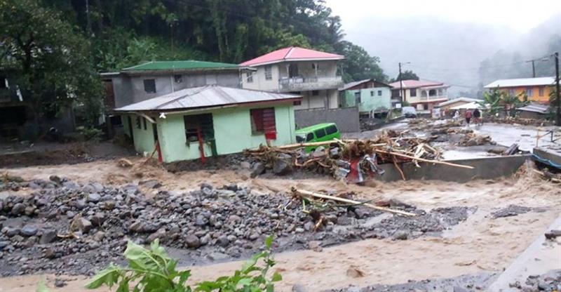
Maria, the 13th named hurricane of the 2017 Atlantic Hurricane Season, became a Category 5 hurricane near the Leeward Islands on Monday, Sep. 18. Hurricane Maria impacted Dominica at approximately 9:35 p.m. on Sep. 18 as an extremely strong hurricane with wind speeds of 155 miles per hour. Maria then impacted St. Kitts and Nevis and Antigua and Barbuda on Sep. 19, and the Virgin Islands on Sep. 19.
At 8:00 p.m. AST (2100 UTC), the eye of Hurricane Maria was located near latitude 18.9 north, longitude 67.5 west. Maria is moving toward the northwest near 12 mph (19 km/h), and this general motion with a decrease in forward speed is expected through Thursday night. Data from an Air Force Reserve Hurricane Hunter aircraft indicate that maximum sustained winds remain 110 mph (175 km/h) with higher gusts. Hurricane-force winds extend outward up to 60 miles (95 km) from the center, and tropical storm force winds extend outward up to 150 miles (240 km). The minimum central pressure based on data from the Air Force aircraft remains at 958 mb (28.29 inches).
View the full report from CDEMA via the attached PDF.